This road trip is one of two which took us across Morocco. We arranged a driver to take us, 6 people, from Fes to Merzouga, south of the country. The journey in a Mercedes minivan started at 7:30 am and covered almost 500 km.
Once we left Fes, we travelled across a plain and approached the Middle Atlas mountain. The Middle Atlas is the northernmost and second highest of three main Atlas Mountain chains of Morocco. In the photo below, the mountain range cast a shadow across the plain as we started ascending in the eastward direction. By the way, the quality of photos in this post is limited by the fact that most were taken from a moving vehicle.

Our first stop was at Ifrane at 1,665 m (5,463 ft). It seemed that this is a popular tourist rest-stop; several vans (like ours) and tour buses were already parked in front of a cafe. We got out to stretch our legs and it was surprisingly cold. We all ordered a hot chocolate in the cafe and stood around a gas fireplace.
Ifrane has a prestigious university – Al Akhawayn University (saw the signs) – that teaches in English. I found out later that my employer’s local affiliate recruited many of its graduates.

The area enjoys sufficient snow fall during the winter months that it becomes a ski resort – often compared to Switzerland by the locals due to the architecture – chalets with steep roof. It is also popular in the summer for its more temperate climate when compared to that of Fes.

The Middle Atlas is 350 km in length in the north-east of Morocco with a rich biodiversity (in opposed to a barren desert) making it a tourist destination. The region is noted for the endangered primate, Barbary macaque monkey, and cedar forests. Our driver took a short stop to say hello to a small troop of monkeys.

To accompany this trip, let’s have something truly local. Track 3 is good.
We traversed the mountain through an area blanked by a layer of light snow.

We descended on the other side of the Middle Atlas via the Route Nationale N13 highway to face the High Atlas mountain range across a desert plain.

The High Atlas rises in the west at the Atlantic Ocean and stretches in an eastern direction to the Moroccan-Algerian border. The mountain range serves as a weather system barrier running east–west, separating the Sahara from the Mediterranean zone to the north and west. I suspect that while the central plain is in the rain-shadow of the mountain, it gets its water from melting snow.

We took a short break at the small town of Zaida to buy some fruits and masks (DL was rightly worried about the shortage) from the local pharmacy that also sold veterinary drugs (the only time I have entered a drugstore that supplies humans and their animals).

Lunch was taken at Hotel Taddart, a large hotel just outside Midelt, which caters to large tour groups in a caravan of buses. The restaurant felt like a college campus canteen (due to its size) while it offered standard tourist menu at tourist prices. We encountered the largest concentration of Asians tourists here (there were at least 3 full tour bus worth of tourists).

Midelt is the provincial capital situated at 1,500 metres (5,000 ft) in the high plains between the Middle Atlas and High Atlas mountain ranges. It is at about the same elevation as Denver, Colorado, United States – the mile-high city.

Continuing on the highway N13, we crossed the central Moroccan plain and negotiated our passage across the High Atlas at the Gorge du Ziz. The scenery at the Gorge was stunning but we did not manage to take any decent photo to show here.

The River Ziz (Oued Ziz), which flows out of the High Atlas and into Algeria (over 200 km), is important as it irrigates all the agricultural lands south of the High Atlas.

The River Ziz widens at one point to form the Barrage Al-Hassan Addakhil, just outside the town of Errachidia.

Around the junction of N10 and N13, we stopped for snacks and bathroom, and admired the view of the Ziz valley. Where there is water, there are palm trees. If you look for the Ziz river on google map, you will find a green ribbon snaking across a vast expanse of featureless yellow background.

As we approached the oasis town of Erfoud, the terrain became flat and the surroundings started to look like a semi-arid desert. Since leaving Fes, we had passed through at least three biomes.

Erfoud was the filming location of The Mummy, Prince of Persia and Spectre (James Bond), and is best known for fossils. Then, we passed Rissani, the nearest market town to the Erg Chebbi sand dunes – the reason for our visit.

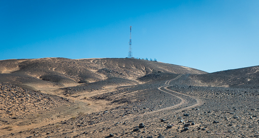
This route is apparently a well-trodden path for those who wants to see the Sahara while visiting Fes. N13 is a single lane highway which ends at Taouz not far further south. We were glad that this trip was not made during the European holiday seasons.

Our destination, Merzouga, is a small village about 35 km (22 mi) southeast of Rissani and only about 50 km (31 mi) from the Algerian border. It is the base for most tourists who are going onto the Erg Chebbi sand dunes.

We reached the end of our day-long ride in the minivan, and were transferred to a 4×4 SUV somewhere on N13, past Merzouga but before Khemliya. As far as we could observe, all the activities in Merzouga and Hassilabied (a village nearby) are associated with tourism, hotels, quad rentals, restaurants, tour operators, etc. I read somewhere, that people call this area a desert theme park.

We transferred into two 4×4 SUV (no 4×4 SUV that can accommodate all six of us) and drove a further 10-15 minutes off-road to get to our destination. We arrived at our desert camp and were greeted by the staff. It was after 6pm and the sun was setting (hence, the long shadow of our SUV on the ground).

It was almost an 11-hour journey, door to “door”. We were tired but also energized by the change of scenery.


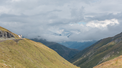


 There is a small lake, a cheerful, rusty sculpture, a restaurant and a hotel at the pass.


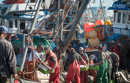
 As fishing boats were arriving every 15 to 30 minutes, the number of people working shoulder to shoulder at dockside was mind-boggling. Most of the work on the wooden boats and on the docks were done by human labor. There was not much mechanization and no automation.


 Cleopatra’s?
 Very colorful faux Egyptian decorations in a giant set.


 At one of the tourist shops, we saw the prices of the products and they were not what one would expect at the source of its main ingredient. The cosmetics appeared relatively crude (simple rose scents plus what sounded like industrial chemicals). Packaging and perception are so important in this business. But … at least the local taxis are pink.