This is Jungfrau Circuit #3 – our train journey to the Top of Europe. See part 1 and part 2, here and here.

After Eigerwand, the second and last stop under the mountain is Eismeer. Like Eigerwand, we have 5 minutes to look out through the giant windows. But unlike Eigerwand, all we saw was snow.

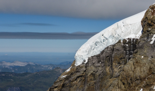
Located just behind the south-east face of the Eiger, one can observe the Grindelwald-Fiescher Glacier through the window.

According to Wikipedia, the station opened on 25 July 1905, with the extension of the Jungfraubahn from its previous terminus at Eigerwand station. The building of the line this far had depleted the railway company’s finances, and for the next seven years, Eismeer was to remain the upper terminus. After further fund-raising and an extended construction period, the line was extended to Jungfraujoch station in 1912.

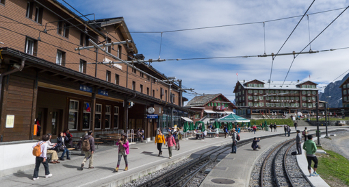
Jungfraujoch is an under-mountain railway station situated below the Jungfraujoch col at 3,454 meters (11,332 ft). It is the lowest point on the mountain ridge between Mönch and Jungfrau.
What a place to do hang-gliding !

But the Jungfraujoch railway station, at an elevation of 3,454 meters (11,332 ft) is the highest railway station in Europe and is connected to the Top of Europe building.
 We first heard a roar and a few seconds later, these two jets just flew right pass the Jungfrau. Spectacular flying ! We assume those planes were used for air show or tourism since they were bright red. Lucky that I managed to get a shot of them.

This is the summit of Jungrau – just partially hidden behind clouds. When we first arrived in Interlaken, the tourist office folks told us to wait until the third day when the weather was fairer, otherwise there is nothing to see. Thank you for the advice !

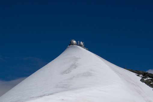
The Sphinx (3,571 meters or 11,716 feet) is a peak that lies just to the east of the col. Try match the two photos above of Jungfrau with the view on the left side of the viewing table.

At one of the vantage points, there were viewing tables in multiple directions which list the Alpine and Jura peaks that are visible. The photo below corresponds to the view on the right side of the viewing table.

Same direction but zoomed in to get a better view of Kleine Scheidegg and the little Fallbodensee.

Looking in another direction at the Great Aletsch Glacier which began at the bottom of this spot and extends 22 km – the longest in the Alps.

A zoomed-in view of the Grosser Aletschglectscher.

There is an elevator to its summit, where a small viewing platform and an observatory.

To a get a sense of how the whole area looks, click on the map below to get a jumbo version.

The tour continues in our next post.

 #48 – LV vespa – New York


 The statutes represent those that were installed at the Yuanming Yuan in the Old Summer Palace which was razed and looted by British and French soldiers in 1860.


