Skip navigation

Category Archives: flora and fauna

Continuing with our story about mountains and …

We woke up at six something and hurried out of the hotel to see the sunrise. Thankfully, the fog had dissipated overnight and the sky above us was clear.

Since Hotel Bellevue was already at the top, it was technically unnecessary to climb higher to see sunrise. But we followed the hotel’s suggestion to get atop of Esel (Donkey) at 2,118 m [6,949 ft] – the second highest point of the entire Pilatus range, just east of our hotel.

It took us about 15 minutes to reach the peak of Esel – we practically ran up the steps as we were a bit worried about missing the moment when the sun appears above the horizon.

Gasping for air which had no moisture at that altitude, we were dying of thirst by the time we reached the top. There were about 10-15 people at the Esel summit which was walled-in and crowned by an iron triangulation cross. The crowd’s sense of anticipation was at a level usually met at a concert performance, and yet sunrise is a daily thing that we all take it for granted.

At 6:56 am, an orange disc emerged from the horizon and rose above the distant mountain ranges. Dawn !

The peaks of the surrounding mountains were first to reflect the warm glow. The view of Lake Lucerne and the city of Lucerne below, visible between gaps in the clouds was spectacular, as was the view southward to the Alps.

There is no word to describe the beauty of the moment and the uplifting of spirit as the rays lit up our faces and the vast expanse above and around us.

Rise and shine. As the sun crept up from the horizon, long sharp shadows were cast across the two hotels and the terrace. We hung around to take pictures and videos along with a small crowd of now excited and satisfied spectators.

On our way down from Esel, we saw a wild mountain goat, also known as an ibex, the kind that is famed for perching on cliffs and jumping off mountainside. It caught us by surprise.

This animal was a baby as its horns were small. In adults, the horns are huge, curved and menacing. Check the photos on the internet. The species was seriously endangered in the Alps until the 1820’s when ibex hunting was banned by the dukes of Savoy in Grand Paradiso (a national park in the Italian Alps). Now they are not so rare in these parts.

Apart from the aerial cable car that we used, there is a second form of transport to get up to Pilatus-Kulm – the cogwheel train. This feat of engineering was commissioned in 1889, having a gradient of up to 48 percent that is the steepest cogwheel railway in the world. From Alpnachstad, it takes about 30 minutes travel time.

Track for cogwheel railway

When we came down from Esel, the first cable car and cogwheel train had not yet started. So we pretty much had the terrace, any sunning chair, telescope and all the viewpoints and trails to ourselves (and a few overnight guests).

I(Chris) decided to explore the “Dragon Trail” which wraps around the mountain behind Hotel Pilatus-Kulm and includes a series of short tunnels cut into a side of the mountain. Windows were created to provide a better vantage point for the view of Lucerne and central Switzerland.

Hotel Bellevue and the aerial cable car terminal from “inside” the Dragon Trail

While it was not cloudy at 2000-plus meter, it would appeared to be a cloudy morning for someone below. We could see a bed of cloud slowly creeping across the woodlands and pastures at lower altitude.

Klimsenhorn Chapel (Klimsenkapelle) at 1,864 m and its crucifix present a set of distant but stunning subjects in the scenery. The neo-Gothic building was inaugurated in 1861 and originally belonged to the Hotel Klimsenhorn, which was demolished in 1967.

The rising sun casted a long shadow behind the chapel.

The chapel remained and is now preserved by a foundation. It was last renovated in 2004. A trail visibly leads up to the crucifix. Just imagine the inspiring, spiritual sight as you walk up to it.

The Dragon Trail afforded different views from the other side of the mountain behind Hotel Pilatus-Kulm. Being the only one on the Trail, I really appreciated the sense of solitude.

Towards the end of the 10-minute walk, the paved Dragon Trail became a series of steps with switchbacks, culminating in a nearly-vertical climb though a hole. A surprising view greeted me as I emerged near the top of Oberhaupt – the other peak that is accessible directly from the terrace.

Oberhaupt (Head-Leader, 2,105 m [6,906 ft]) is located west of Hotel Pilates-Kulm. I was really glad that there were no masses of tourists on the narrow path.

The peak of Oberhaupt is closed to the public due to the communication installations. At that altitude, there were no trees only shrubs.

Hotel Pilatus-Kulm and the terrace and Oberhaupt from Esel

Following a paved path and stairs, I came back down to the terrace next to the hotel, effectively completing a circuit. As there were hardly any one around, it was tempting to do a quick hike on an easy trail to the third and tallest peak – Tomlishorn – which is 20 minutes away.

Instead, I joined Sue for a nice buffet breakfast at the Queen Victoria. After all, with a healthy dose of fresh mountain air, we were very thirsty and hungry by that time.

When we were checking out of the hotel, only a few fluffy clouds remained and the city of Lucerne 1700 meters (5500 feet) below us was visible from our window ! This kind of view of the ground is usually possible only from an airplane.

Click here to see the hotel, cable car and gondola in part 1.

We had a really memorable overnight stay.

Back to Switzerland …  On our way home back from St Moritz, we spent a night at a sheep farm at Alp Flix. 

Click on the link to see our earlier posts on St Moritz, and the nearby Julierpass.

Alp Flix is a protected moorland situated on a plateau of between 1900 and 2000 m altitude, lies within the boundary of Parc Ela – the largest nature park in Switzerland.

The farm Cotti Agricultura is in the hamlet of Tgalucas (top right corner on the map; 1970 m, 6463 feet).  Their web site in German (possibly Swiss German) is here.

To get to the farm, we turned into the village of Sur just after descending from Julierpass on A3. There is a restaurant/hotel, and a church. We saw hunters dressed in camouflage standing next to their truck having a smoke. Wondered what they were hunting.

We continued on the road and started ascending into the low-lying clouds. The paved road became a gravel path lined with two rows of bricks. Conifers lined the road.

After a short climb, we reached the flat plateau which gave us the impression of entering a separate otherworldly realm. The village below was no longer visible, nor were the mountains ahead/above us.

Alp Flix is apparently a popular place for hiking. Cotti Agricultura is not only a farm, it is also a cafe/bar/restaurant, sells home-made milk and cheese, and provides simple accommodation.

The front of the farmhouse has been converted into a reception, a bar and an open kitchen area. When we drove up to the farm and checked in, we were told to park the car at a public parking area about 10 minutes downhill.

Reluctantly, we drove back down to leave the car and walked back. We saw the largest (poisonous) mushroom ever.

It was a nice fresh walk as the drizzle had paused.

Tgalucas

We met the resident shepherd on the kitchen floor – a very smart and alert animal.

The day was grey and misty but it added a lot of mood to the moorland. Cotti Agricultura kept only sheep and we noticed the smallish milking machines. The owner noted that cattle farming requires more land and a much larger scale of operation.

But we did not see any sheep. Perhaps they were all herded up into the mountain to take advantage of the summer pastures, as we were there in early September. We believe they all went up the road that runs alongside a stream behind the farm.

Our dinner (lamb chop, unsurprisingly) was served in a small dining room behind the kitchen. It was spacious for 15 diners. The back of the dining room was a wine “cellar” and behind it, with its own entrance from the outside, the toilets and shower area.

The main reason we chose to stay at Cotti Agricultura was the yurts. They had installed five for guest accommodation. For us, the concept was “camping” in the Alps.

A traditional yurt (from the Turkic languages) or ger (Mongolian) is a portable, round tent covered with skins or pelt and used as a dwelling by several distinct nomadic groups in the steppes of Central Asia.

The yurts are a gimmick and it was popular with visitors. All were booked that evening. No animal pelts were used to make these tents. The white plastic-lined, wood-framed tents were a bit sterile, minimally decorated by a door painted with ethnic motifs.

Next to our yurt, there was a tiny sauna. Nobody used it. For us, we would not enjoy it as, it was rather wet and chilly when you come out. Maybe Scandinavians would like it.

There was no running water or toilet in the yurt. The farmhouse was very close-by so it was not a problem (not for us anyway, since our yurt was the closest to the house).

The yurt felt very roomy inside, except the lack of headroom. We had a circular bed, a couple of stools, and a sideboard. There was a wood-burning fireplace with a chimney sitting on a slab of concrete in the middle of the tent.

There was not a need to use the heater but the risk of carbon monoxide poisoning did cross my mind. No electricity, so we used the provided candles for light. We liked the idea of getting away from modern amenities, like wifi, for just one night. It rained a bit overnight. We slept fine as we must be tired.

Woke up to fresh air, similar foggy grey skies, wet grass. Felt alive and well.

We left after a big breakfast, and rejoined A3 heading towards Albula and then Chur. Our next stop before reaching home was Mount Pilatus near Lucerne.

Todra Gorge is one of the detour from our 3-day road trip from Mezouga to Essaouira. See earlier post here.

The Todra Gorge (or Todgha Gorge, Gorges du Toudra; in Tamazight: ⵜⵉⵣⵉ ⵏ ⵜⵓⴷⵖⴰ; Arabic: مضيق تودغا‌‎) are a series of limestone river canyons, in the eastern part of the High Atlas Mountains, near the town of Tinghir.

A local guide took us for a walk along the canyon floor, through palmeraies and one of the villages, and we crossed the Oued Todra several times.

We did not go further upstream, but we read that the canyon narrows to a flat stony track, in places as little as 10 metres (33 ft) wide.

Lonely Planet said that the best time to visit is in the morning when the sunshine briefly illuminates the gorge in a golden moment of welcome. Well, we were there late in the afternoon and saw the warm rays of sunset lighting up the upper halves of the cliff face.

We walked along and on the banks of irrigation channels by which river water is diverted into the fields of vegetables, and almond trees and walnut trees. The almond trees which flower in early spring were blooming.

Our local guide spoke English well and told us a lot about stem grafting to propagate the almond trees.

We walked through a Berber village with abandoned mud brick houses. Berbers are an ethnicity of several nations mostly indigenous to North Africa and some northern parts of West Africa.

The Moroccan Constitution, amended in 2011, lists Tamazight the language spoken by Berbers as an official language together with Arabic. In June 2019, Moroccan lawmakers approved a bill requiring Tamazight to be taught to all Moroccan students.

One of the main characteristic of Tamazight that has confused Tamazight speakers is that there are many dialects. Tamazight has three major varieties. Tashlhit, Tamazight and Tarifit. And each of these dialects consists of many sub-dialects.

The teaching of Tamazight is now accompanied with the Tifinagh alphabet (neo-tifinagh), which many Tamazight speakers still aren’t familiar with, having been accustomed to write the language in the Arabic or Latin alphabet. A modernized form of the Tifinagh alphabet was made official in Morocco in 2003. Before this point Tamazight did not have a literacy tradition, even though it has had a written tradition going back 2500 years.

This is Tifinagh written in Tifinagh ⵜⵉⴼⵉⵏⴰⵖ . Tifinagh has been added to Unicode Standard in 2015 and its block range is U+2D30–U+2D7F. We hope your computer can support the display of these codes, otherwise you would have been seeing boxes.

For many years, giving children Amazigh names was forbidden in Morocco, and administrators would often refuse to enter these names into the civil registries. The effect of such a ban was the exclusion of those who speak the language – usually people from poor, rural areas of the country – from participation in various aspects of public life.

Apparently during the high tourist season, souvenir stands and tour buses clog the road.  We did not see anything close to regular vehicular traffic or even a piece of souvenir, lucky us.

Can you see Sue and the guide ahead of me in the photo above ? The vertical rock faces offer excellent rock-climbing routes. Something that we were not going to be able to enjoy.

Our driver was waiting for us further upstream at a scenic spot. We had a nice, gentle 90-minute walk while the sun was slowly setting behind the mountain.

Our first detour after we left our Merzouga desert camp on our cross-country drive was a fossil factory or rock shop – Morabit Marbre Fossils, at Erfoud – the fossil capital of Morocco.

During the Devonian period, the Paleozoic Era, from about 450 million years ago, this area of the Sahara was the floor of a large prehistoric ocean. It is now prime digging grounds for fossil hunters. We stopped by a fossil field the day before when were exploring the area. See earlier post here.

The most common fossils here are trilobites. Trilobite fossils are found worldwide, with many thousands of known species.

Shown above are ammonites which were molluscs (like squid, octopus) but they had a hard coiled tubular shell as well as a soft body. In its shell, there was a series of progressively larger chambers that are divided by thin walls. Apparently, only the last and largest chamber, the body chamber, was occupied by the living animal at any given moment. As it grew, it added newer and larger chambers to the open end of the coil. The ammonites first appeared in the Devonian period (circa 409 million years ago) and became virtually extinct at the close of the Cretaceous period (circa 66 million years ago) along with the dinosaurs.

We bought one which had been sliced open into two halves and were polished.

I found a rock with numerous ammonites on a digging site from a day earlier. See earlier post here.

This workshop/shop has a courtyard full of large sheets of rocks in which are embedded the fossilized organisms.

Photographs show workers breaking up huge pieces of marble/rocks by pneumatic drilling, and hauling the big pieces back to the workshop where sheets of rocks were carefully sliced off like white bread.  Some of the sheets are about about 10 cm thick.

They are made into ornamental displays, or practical things like tabletops, fountain and bathroom pieces.

In addition to the regular patterns of marble, the slabs of marble on offer here contain fragments of fossils scattered in it.

Apparently, it is rare to find fossils in perfect condition so the miners take their finds to fossil “factory” to have them restored. The composition and placement of the fossils on these slabs (see photo below) looked a bit too perfect to me. Perhaps the fossil themselves are genuine but they were assembled and fixed in a new background.

It must be worrisome for shoppers to hear that fossil replicas can be made from plaster, plastic or even auto-body putty. Not knowing what the real deal looks like, it can be hard to distinguish them.

The shop also offers a huge selection of rocks and minerals. Some are in their natural form.

We were the only customers in this showroom. But during peak season, there must be busload of tourists descending on this emporium.


Erg Chebbi is a small sea of sand dunes stretching 22 kms long and 5 kms wide and peaking up to 150 metres high. Formed by wind-blown sand, Erg Chebbi is known for its golden-orange sand formations that start at the most northern tip of the Sahara. We arrived at our camp just after 6 pm and were rushed onto our camels’ back for a trip out onto the dune before sunset.

Prior to the trip, I was rather apprehensive about riding a camel for any length of time longer than half an hour. I read somewhere and friends told me that it is an overrated experience, the discomfort far outweighing any fun and novelty aspects. The most common complaints are a sore arse and seasickness.

Luckily for all of us, getting onto the camel was relatively straightforward.  The animals were well-trained, calm and knew what it was supposed to do with minimal fuss. Our guide was very experienced, knowing exactly how to get us posing on camel back in formations for some great pictures.  From left to right, on the camels were SG, IL, IT, Chris, Sue and DL.

After lumbering about for 10-15 minutes, we got off the animals and walked up to the top of a dune which offered a view of the sweeping sea of sand. And it was so eerily quiet.

The sun was below the horizon and the intense orange color was starting to fade out of the boundless sandscape. This was a memorable high point of the trip.

There was not much camel-riding in the end to test the cautionary theories properly. No one complained about any ill effects after the ride.

Having seen the animals up close, I came to appreciate the stoic hardworking camel that serve the nomads for centuries as the only means of transportation across this hostile terrain.

The word “erg” came from the arabic word “arq” meaning a dune field. Erg Chebbi is technically only in an area of semi-arid pre-Saharan steppes and not part of the Sahara desert which lies some distance to the south. And our camp is located at the edge of the sand dune so we were not as “in” the Sahara as we’d like to believe.  But the featureless desert and the rise and fall of the dunes were real and gave us a taste of the Sahara.

By the time we got back to our private tent, dinner was almost ready. While the structure of our tent was formed by a metal frame with layers of fabric, it had a hinged door, an air-conditioner, a shower and a sit-down toilet. What a luxury in the middle of a desert. We were so pampered, and could now claim to have enjoyed the quintessential desert experience, the clueless tourist version.

There were a total of 10 tents in this camp. Only two were occupied on the first night, we met the other guests at dinner – a couple from China, and a father and his grown son from Argentina. The tents form a semi-circle with a dining tent at one end. The kitchen, storage and staff quarters were in a small concrete building hidden behind the dining tent.

The dining tent had a high ceiling, silky-plush sofas, spacious table settings, and air-conditioning (not needed).  The food was a better-prepared variation of the tourist menu we had encountered so far.  It was good and we enjoyed it.

Entertainment was provided in the form of traditional songs accompanied by drums and krakebs (a large iron castanet-like instrument). The guy leading with a drum set was also the chef! It was an enthusiastic performance, lasted at least 20 minutes and they seemed to enjoy it as much as we did.

I wondered if they are Tuareg Berbers as most of them wore the indigo-blue djellabas. Tuaregs as a Berber group are semi-nomadic scattered through southern Algeria and Libya, Niger, Mali and Burkina Faso.

A bonfire was lit and we all sat around it to keep warm, and stared at the night sky. We, city-dwellers do not get to see the milky way much and it was mesmerizing and thought-provoking.

Our first night glamping in the desert was quiet and event-less. Slept better than when we were in Fes, in fact.

The following day was another cloudless sunny day. It was then when we had a proper look at the camp (or the resort shall we say). Here is a view of the camp from the dining tent in the morning.

View of the dining tent from the ring of seats around the bonfire.

The format of the served breakfast was similar to an international hotel but with a Moroccan twist – a hot egg-based dish (arrived in a tajine clay pot), several kinds of bread with local honey and jams, pastries, fresh fruits, and unlimited orange juice and coffee. It was scrumptious and plentiful.

Yes, we had had “Tea in the Sahara” – also a 1983 song by The Police, inspired by The Sheltering Sky – a book I was reading on the trip – see our post here.

We saw pigeons around the camp as there was a grove of trees nearby.  But I did not recall seeing any insect.  Apparently many of the desert animals and insects are nocturnal. The evidence of their movements could easily be seen.

We spent two nights at the camp so a full day was available to looking around the area. See later posts.

A group of Chinese tourists arrived during the day and took up all the other tents. Their itinerary was brief – they rode the camels, enjoyed dinner accompanied by the singing and drums, and promptly departed the next morning.

We had a guide/driver for a day in Marrakech and he brought us to Musée Yves Saint Laurent, Marrakech (mYSLm).

Concurrent with the opening of Musée Yves Saint Laurent, Paris (Av. Marceau), the Foundation Pierre Bergé-Yves Saint Laurent created this museum in 2017 with the Foundation Jardin Majorelle.

A retrospective movie Yves Saint Laurent was made in 2014. Here is the soundtrack, it has a few opera favorites and nice quiet piano pieces.

The main hall of the museum (photos not allowed) shows a retrospective featuring 50 pieces representative of the essential work of YSL from 1962 to 2002 including the pea coat (1962), the Mondrian dress (1965), “le smoking” tuxedo suit (1966) and the safari jacket (1967).

He designed clothes for women that borrowed from a masculine wardrobe, “avoiding the fashion of the moment and give them more self-confidence”.  Catherine Deneuve and Isabelle Adjani wore his designs in various movies.

The museum also has a space for temporary exhibition, an auditorium where we saw a short documentary film, a cafe and a bookshop.

YSL was trained at the House of Dior and in 1957, he found himself, at age 21, the head designer after Christian Dior died of a heart attack in his fifties.

In 1961, he opened YSL couture house with Pierre Bergé in Paris.

Les Quatre Saison (The Four Seasons) posters by YSL in 1983.

In 1970, YSL designed the first in a series of greeting cards with the word “Love” in poster form that he would send his friends, collaborators, and clients annually until 2007.

The YSL museum is adjacent to the Jardin Majorelle which was saved from demolition by Pierre Bergé and YSL in 1980. The garden (English link here), also opened to the public, was designed by the French artist, Jacques Majorelle (1886-1962) in 1923.  Jacques Majorelle commissioned the architect, Paul Sinoir, to design a Cubist villa for the property in 1931.  I included a copyright-free photo below because it was impossible to take a picture due to overcrowding.

YSL was born in 1936 in Oran, Algeria and seemed to have a great affinity for north Africa.  He and Bergé collected over 600 traditional North African objects and a Berber Museum (Le Musée Berbère, linked here) was created in 2011, which houses their collection.

Majorelle was a celebrated Orientalist painter, and a special shade of cobalt blue was used extensively in the garden and its buildings which is named after him, bleu Majorelle –Majorelle Blue. Everywhere in the garden, the blue is contrasted with almost-neon lemony yellow and deep vermilion-orange.

The garden offers a series of walkways at different levels among the boldly-colored buildings. There is a large collection of cactus, all perfectly laid out and beautifully managed.

The garden was extremely popular and it was packed with tourists. There was even an Asian couple taking bridal pictures. I cannot imagine the crowds during peak tourist season.

YSL and Bergé were a couple but they split amicably in 1976 and remained lifelong friends and business partners.

Just before YSL died in 2008 of brain cancer, Bergé married YSL. His body was cremated and his ashes were scattered in the Jardin Majorelle. Bergé died in 2017.

Continuing with our desert adventure in Wadi Rum …

Wadi Rum is Arabic for “Sand Valley”, as Rum ( رَمَّ‎) means sand, especially light sand that can be carried by wind.

The official site describes …

Wadi Rum is a protected area covering 720 square kilometers of dramatic desert wilderness in the south of Jordan. Huge mountains of sandstone and granite emerge, sheer-sided, from wide sandy valleys to reach heights of 1700 meters and more. Narrow canyons and fissures cut deep into the mountains and many conceal ancient rock drawings etched by the peoples of the desert over millennia. Bedouin tribes still live among the mountains of Rum and their large goat-hair tents are a special feature of the landscape.

If you are curious about the local geography/topology, there is a map of the desert and rock formations online here.

The experience in the desert was otherworldly to say the least. There was not much wind (thankfully) and it was not scorching hot. There was no smell.

Distance was difficult to estimate except by the haziness of more distant objects. By the way, there are a few tents just below the smaller rock formations if you can spot them.

While criss-crossing the desert in canyons formed between the little and big rock formations, our guide took us to see some markings made at Thamudic times. Apparently, as much as the desert looks hostile, Wadi Rum has been inhabited by many human cultures since prehistoric times.

Nearby there was a caravan of camels … that is another touristic thing to do. All the people living in and around Wadi Rum today are of Bedouin origin and, until recently, led nomadic lives, relying on their goat herds.

Have a camel ride in the desert … exotic but I think it would be really uncomfortable and potentially dangerous if one does not know how to ride. 

There are sand dunes and they are found mostly piled up agains the rock formations. They are difficult to climb as your feet sinks into the ground and sand pours into your shoes.

We started around 3-4pm, so by the time we saw the camels, it was getting hazy as the sun is setting.

Not only the vista was stunning, it was also very quiet (except when we were on the back of the truck with the engine and wind noise).

Our guide said he will give us a treat by taking us to a spot to see sunset (Al Ghuroub). We sat on this rock ledge and enjoyed the silent sweeping vista. The sun was mostly hidden behind clouds on that day.

Transcendence is the word.

This spot, not only afforded us with a vantage point, it was also used in the movie, the Martian. Many other movies about Mars were made around here. 

What a memorable adventure !

Yakushima was registered as a UNESCO World Natural Heritage Site in 1993. It is also called “the island of ancient forest and water” because of the huge Yaku cedars, which are over 1,000 years old, moss and abundance of rain.

yagusukiland-1

According to wikitravel, the island’s forests are not virgin. Hundreds of years ago, most of its ancient trees were cut for lumber. The stumps remain everywhere, often uncorrupted and covered with moss or sprouting other trees, including second and third-generation Sugi – in the continually regenerating forest. The remaining Japanese cedar trees over 1000 years old are termed yakusugi, and many revered trees have been given individual names.

Sennensugi (千年杉, thousand year cedar) in photo below.

yagusukiland-8

The symbol of Yakushima is Jomon-sugi or the Jomon cedar that is estimated to be between 2100 years old (the oldest date that can be confirmed by carbon-dating of core samples) and 7200 years old (based on its size). The course to visit this tree is 10.7km (6.7 mile) long one way from the entrance of the mountain and it takes about 10 hours for a round trip. Obviously we did not attempt this journey.

yagusukiland-7

The Jomon-sugi was probably first discovered hundreds of years ago by Edo period loggers, and, like the other ancient cedars, it escaped logging due to its irregular shape. It was rediscovered in the 1960s and has since been protected along with the rest of Yakushima’s forests when the area became a national park.

yagusukiland-4

Yagusuki Land 屋久杉ランド is not a theme park despite the “Land” in its name. It’s actually a wonderfully scenic area of forest that was logged in Edo times and now offers a variety of easily accessible hiking trails that pass a number of fine yakusugi specimens.

yagusukiland-5

There are 4 circular trails to follow: ranging from 30 mins to 150 mins. After our daylong hike in Shiratani Unsuikyo the day before, we took it easy and followed one of the shorter trails.

yagusukiland-2

The scenery here is beautiful and similar to what we saw at Shiratani Unsuikyo  – lots of moss-filled forests.

yagusukiland-15

Streams with moss-covered rocks.

yagusukiland-6

Yakusugi Land is just south of Anbo and from there a 30-minute ride by bus up an increasingly narrow and winding mountain road.  We saw families of monkeys on the roadside sunning themselves.

yagusukiland-14

Human activity being a relatively small part of island life, there is abundant wildlife, notably a large deer and monkey population. Unlike some places where monkeys and humans interact, Yakushima monkeys are not fed by residents or tourists and so do not approach cars or persons for food.

yagusukiland-3

On my return trip, we stopped by the Yakusugi Shizenkan 屋久杉自然館 where a lot of interesting facts and history are on display.

yagusukiland-9

A tree limb of the Jomon-Sugi that fell due to heavy snowfall several years ago is exhibited here. One can attempt counting the annual rings  – magnifying glass provided.

yagusukiland-12

There are photos, movies and hands-on exhibits showing the island’s natural wonders and the history of the logging industry.

yagusukiland-10

The cedar tree harvesting began in the 1650’s which were made into shingles for roofing (hiragi) due to its high resin content and resistance to rot.

yagusukiland-11

A short walk away is the World Heritage Conservation Center. More photos and models were shown here about the island. Perfect for middle schooler as a field trip.  Parts of it were under renovation.

yagusukiland-13

Overall, because of the remoteness of the island and difficulty of the terrain generally, there are relatively few tourists. And the fact that it was offseason, we had the places to ourselves. We loved it.

Comparable to the red wood forests in California, this is Japanese treehuggers’ mecca. See our post on Shiratani Unsikyo here.


Shiratani Unsuikyo was our first hiking destination on the island – it is a ravine – with a pretty name (白谷雲水峡, white valley cloud water ravine). It is one of the three most recommended hikes for the island – probably the top choice.

shiritani-1

We took the bus from Miyanoura which climbed the inland mountains. The road was surprisingly well-paved and wide. It must have been upgraded over the years due to the popularity of our destination, tour buses are expected. But there were hardly any cars on the road.

shiritani-2

The ravine is part of the Kirishima National Park which offers a network of reasonably well-maintained hiking trails that run along and around the ravine. We picked one that on paper will take two and a half hours roundtrip – from no.1 to no. 13 and back via no. 12 – the longer loop. It took much longer, as we expected, knowing our legs.

shiritani-3

Shiratani Unsuikyo can be closed during a heavy rainfall as the rivers can become too dangerous to cross. We were lucky in that it did not rain so there was no wading across the streams (we had to hop across at least two small ones) – the small photos in the notice board above illustrate the difference in volume before and after rain. The streams are indicated with a ” ! “.

shiritani-4

It must be spectacular during the rainy season here.
shiritani-6

Yakushima is one of the wettest places in Japan (about 10,000 mm of rainfall in a year in the mountainous area).

shiritani-5
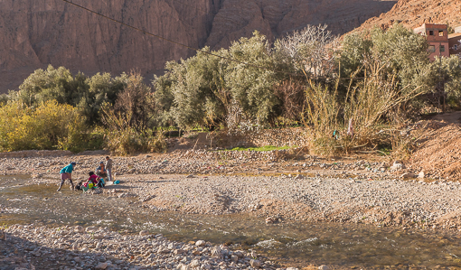
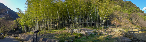
It was very pretty here.

shiritani-7

Beyond this bridge, the trail was no longer paved and it became steeper. We did not cross at this point as we took the prettier route (according to Wikitravel).

shiritani-8

One of the main attractions of Shiratani Unsuikyo is a part of the forest that served as the inspiration for Miyazaki Hayao 宮崎 駿 (Studio Ghibli) – animated film Mononoke Himeもののけ姫 (魔法公主, Princess Mononoke).

shiritani-10

There are more than 600 species of mosses on this island and they grew on top of each other forming dense layers on almost any surface.

shiritani-12

The lead artist for the film – Princess Mononoke, spent lots of time here working on sketches for the movie’s forests – the sinister-looking roots were spreading and crawling over fallen logs and even living trees.

shiritani-9

The altitude is 600m (1969ft) at the entrance and about 900m (2953ft) in the forest of Princess Mononoke.

shiritani-11

The fact it did not rain also meant that the rocks were not slippery. Despite having the right footwear, it was still tricky to hop from one moss-covered rock to another.

shiritani-14

Along the way, we saw many ancient cedar trees.

shiritani-15

Some roots and trunks were so ancient that one can pass through the spaces beneath their roots.

shiritani-16

Our turnaround point was the Shiratani hut – “white mountain hut” which is provided as a place where one can camp. We returned using a different path, the Kusugawa trail one that was used by loggers who harvested the trees in the Edo period.

Exhausted but it was good hiking, and made soaking in the hot springs and a multi-course dinner all the more deserving.


After visiting Lake Fudoika, we came down the Kirishima mountains by taxi and came to this garden in the afternoon. Sengan-en 仙巌園, is a Japanese garden attached to a former Shimazu 島津氏 clan residence in Kagoshima 鹿児島.

senganen-1

Together with the adjacent Shōko Shūseikan, it forms part of the UNESCO World Heritage Site that focus on Meiji’s industrial revolution. Shoko Shuseikan is a museum set in a 150 year old stone building originally used as a machine factory.

senganen-2

The Sengan-en residence was built by Shimazu Mitsuhisa (島津光久), a feudal lord in 1658. The name “Sengan-en” is derived from a supposed resemblance to a rock feature on Long Hu Shan in China.

senganen-6

The Shimazu was one of the families of Edo period daimyō (lord) to have held their territory continuously since the Kamakura period, and would also become, at their peak, the wealthiest and most powerful family.

senganen-5

There were mandarin orange trees in the garden (above photo).  I (Chris) know these small oranges are known as satsuma in England. Apparently, the name came from the Satsuma (薩摩) area owned by the Shimazu clan which fought a war with the British that was trading in 1863 (Anglo-Satsuma War 薩英戦争).

senganen-9

Due to the proximity, China had quite an influence in this area. In 1736 Shimazu Yoshitaka (島津吉貴) added a kyokusui (曲水) water feature and moso bamboo, obtained from China via the Ryūkyū Kingdom.

senganen-8

Bamboo forest

senganen-13

“Big bonsai” – we called it.

senganen-7

The Shoko Shuseikan and this area of Japan were fundamentally important in the modernization of the country. It was here that Western industrial technology was introduced, studied and used in the creation of modern factories. We did not spend much time here but it was one of the more interesting museums we visited.

senganen-3

Some of the small old houses are converted into shops, selling all kinds of souvenir, handicrafts and snacks.

senganen-4

A stream runs through a part of the garden – the stream barely visible in the picture below. But a tradition -Kyokusui no En – is renacted here at least once a year.  It is an elegant poetry game originating in ancient China in which small cups of sake are floated down a winding stream. Participants dressed in traditional clothing sat along either side of the stream must write a poem before the cup passes in front of them. On completing their poems the participants take the cup from the stream and drink the sake.

senganen-12

Apart from the main buildings, there were also little shops scattered in the garden selling crafts – very low key.
senganen-15


The garden has a direct view of Sakurajima – an active volcano – they sell many postcards of the volcano spewing smoke and lava. It was not active while we were there – just clouds.

senganen-10

There is even a shrine dedicated to cats here !

senganen-14

The garden is beautiful, touristy but not tacky. It was fun to have a driver for a day.

Click here to see the lake in the Kirishima mountains.


Continuing with Den Blå Planet (the blue planet) in Copenhagen …

See earlier post here … a few more photos of the building’s architecture.

blueplanet-24

Futuristic without feeling cold, I may even say it looks organic, possibly because there were no right angles or sharp corners in sight.

blueplanet-23

They have very few mammals but this pair of sea otters are new arrivals and very cute indeed. We also saw some otters in Lisbon’s aquarium, they are ever so entertaining (to see more otters, click here).

blueplanet-22

This section of the aquarium is the Amozonas – the sunken forest, which features Europe’s largest herd of carnivorous piranha – I wished we knew the feeding hours – it would be quite a sight !

blueplanet-20

There were giant catfish as well as normal ones.

blueplanet-18

They are a bit more colorful than the ones we expect to see normally.

blueplanet-19

We have no idea what kind of fish this is. They are huge with dark green scales and some orange tinge near the tail. Their heads look fossilized.

blueplanet-16

The skin around its head looks like the exoskeleton of the mature alien in the movies Alien, Aliens, etc.

blueplanet-17

The polka-dotted, flat plaice or flounder are stunning. Those dots serve the opposite function of camouflage ! What is the evolutionary benefit ? To attract mates ?

blueplanet-14

.

blueplanet-15

And there is this one that obviously lives close to land given its muddy color. Just don’t tell me that they are the males and females of the same species with the polka-dotted ones.

blueplanet-13

This look like a giant goldfish.

blueplanet-21

We had lunch at the aquarium and on its menu was fish and chips. I (Chris) went for the shrimp salad – the shrimps were caught in Greenland and hand-peeled !  (as described in the menu)

blueplanet-27

From the restaurant, one can see the turbines for wind energy which has been adopted very successfully here. They sell electricity to Sweden and Germany.

blueplanet-26

Nice aquarium.

blueplanet-25

.

.

This is part 2 of our post on Langkawi’s Kilim Geoforest Park. Part 1 is here.

kilim-15

We made a few stops along the boat trip. The first is a short walk through a tropical jungle and a bat cave on a paved path. The bat was very hard to see from a distance as they were tiny and hanging on the side and roof of the cave in the dark. The only thing we saw was this rattlesnake, probably venomous given the triangular shape of its head. Mind you, this snake was not caged but just coiled up on a tree trunk.

kilim-19

The next notable animal we saw is this swimming reptile. It was at least 4-5 feet long.

kilim-18

Moving up the evolutionary scale, after the reptiles, we saw birds of prey.

kilim-16

These birds are accustomed to being “fed” by tourists and “trained” to fly and dive into the river for handouts (thrown into the water).

kilim-17

Not sure what type of  birds we were seeing, they have orange wings and black “fingers” and a white body.

kilim-27

At a couple of places, the boat slowed to a crawl where we can “interact” with the monkeys onshore. The guide gave us bags of peanuts.

kilim-24.

kilim-22

Sue did not want any of the attention we were receiving from the simian mob.

kilim-21

This monkey boarded our boat and it was obviously very familiar with tourists and felt entitled to whatever that was onboard.

kilim-23

Neither shy nor aggressive. After some peanuts, it pooped on our boat, then disembarked by hopping into the water and swam ashore as our boat pulled away from its gang.

kilim-20

All in all an interesting day.

While in Langkawi, the last stop of our Malaysian trip, we wanted to see a bit of nature (after KL and Penang). So we just signed up for a boat tour of the mangroves around the island. It was all very touristy but convenient.

kilim-1

As expected, we were picked up by the tour operator at the hotel in a mini van, delivered to a pier where the boat operators received us (and guests from other hotels and resorts).

kilim-2

The tourism industry has organized itself into efficient segments, the tour operators who sell the tour and transport the tourists to the boat operators who provide the tour guide and the boat, and deliver us to the fisherman (part time cook) who provided us with lunch.

kilim-3

The tour started with our boat speeding through open water in the Anderman sea, very reminiscent of our trip to the islands from Ko Samui in the Gulf of Thailand. See our earlier post here.

kilim-12

Many hidden beaches and odd-looking rocky islets with dramatic cliffs.

kilim-13

This park is made of several elongated hills and islands with narrow limestone karst valleys in between, and these valleys are home to a unique mangrove forest.

kilim-25

We entered a river mouth where the mangroves are located.

kilim-9

Our boat went through some narrow gaps including the one below with an unbelievably low ceiling.

kilim-8One-way traffic only.

kilim-26

We studied mangroves in geography class but never saw one until now. The word “mangroves” refers to the trees and shrubs that grow in intertidal saline water and evolved roots systems to deal with the salt and wave action.

kilim-31

The mangroove forest is considered a distinct biome as we saw here.

kilim-10

We made several stops including a couple at aquaculture stations. These are floating platforms under which where fishes are kept and sold to passing tourists.

kilim-5.

kilim-4

These are mom-n-pop operations catering to tourists. But aquaculture is a major industry in this part of Asia, providing the world with affordable and sustainable shrimp and tilapia (for example). But we did not see any commercial fish farm here.

kilim-30

We saw various kinds of fishes, including tuna and eel. They are all on the menu.

kilim-28

The tuna was swimming fast in circles. It could put up quite a fight when a net is lowered … however we did not get to see it.

kilim-29

More photos of the wild life in our next post …

kilim-6

We are caught a bit off guard when the admin page of WordPress indicated that our next post will be the six hundredth (600th) that we published. As previously said several times, we are surprised that the interest in keeping up this blog has not fizzled out over the last 5 years. True it is, that we are still living in Europe and away from our friends and families, the primary reason for starting the blog. But we also find that this blog is a convenient medium to capture and frame memories of our time in Switzerland and our travels, and it became a habit and a hobby (at least for Chris).

600th-1

The blog was launched on November 4, 2009. The first trip ever reported here was our visit of Playa de Carmen, Mexico in November 2009 (click here to see). We had not yet left the US at that time but were starting to pack our belongings and worried about the move.

600th-6

Fast forward to now, posts on our quick tour of three cities – Taormina, Siracusa (Ortigia) and Catania – on the east coast of Sicily, taken during Easter, are under preparation now. Our most recent visit to Berlin and Copenhagen earlier this month has not yet been written up. Most of the photos are still in Raw format.

600th-3

Since March 2013, we have been posting a series of photos on Facebook, one a day except Sunday and Thursday when the blog is updated. There is no theme – just something random and per se visually interesting. They are essentially pictures that did not make the blog for some reasons. We gave each a serial number, a minimally-worded title and a mention of where it was taken (to the extent we could remember the location). But we wanted to share them with the readers here too – so we started showing 5 of them in a post – somewhat irregularly. This is the first of the series – #1 – “the history of cool” –  Munich.

stamps-1

So far we have shown about 150 of them here, but on Facebook, we are at #444 – there is a backlog of almost 300 random photos! On days when we are not writing the blog, these photos could keep the blog going for a while. This is #443 – “dark 3” – Taormina.

600th-4

The readership of this blog has stabilized at around 50-70 views per day. Apart from posting a link in Facebook, Twitter and Google+ each time a post goes public, we made little attempts to drive up the statistics. We also signed up Pinterest but have not seen much changes (perhaps we are not leveraging the site properly). But other people have pinned our photos on pinterest.  So if you do not feel like writing a comment, pin a photo.

600th-8

Recently, we noticed that the page view of one of our posts in April on eating durian on the street of Petaling Jaya (click here to see) has gone through the roof (more than 120 views last week alone and maintaining the momentum). It must have caught the attention of certain netizens in Malaysia (as reflected in WordPress statistics), and got linked to an index or a popular site.

durian-7

The reigning champion of page views is still our first post on HSBC’s poster ads as seen around major airports in 2010 (click here). Its two siblings are receiving decent traffic too.

This blog has changed its theme (a WordPress term for the overall look and feel of the blog) only once which happened within the first month of its launch. So the appearance remains constant for the last few years and it is getting a bit aged. But we are hesitant to change to a more modern theme as it could affect somewhat unpredictably the old posts. More experimenting is needed (if we have more time).

600th-5

One day we might want to make a book (or several books) using these photos, like the ones we did for Yellowstone National Park and Iceland back in 2007.

We have been buying books showing photos of a city “then and now” or aerial views of an area.

600th-2

Before signing off, we want to thank our readers for their interest and support, and Susie who has been responding to our posts consistently and ranks No. 1 with the highest number of comments.

600th-9

Your feedback is important as it is the only way we know someone is reading the blog. So please comment, like, retweet, follow, clip, subscribe, pin, bookmark, repost or do some good old-fashioned word-of-mouth. In the meantime, we will continue to share words and images of our adventures.

600th-7

Cheers.

In many parts of Europe, including Switzerland, April and May is the season for this plant which produces flowers with an intense yellow color. colza-4 The plant is known as canola, colza, rapeseed or in Latin – Brassica. It is a member of the Cruciferous (Brassicaceae) family, sometimes referred to as the mustard family. The name “cruciferous”comes from the shape of its flowers, which have four diagonally opposite petals in the form of a cross. colza-5 In Europe, this plant is primarily cultivated to provide animal feed – cattle, due to its high lipid and medium protein content. colza-1  Commercial plantings of rapeseed are recorded in the Netherlands as early as the 16th century. At that time rapeseed oil was used primarily as an oil for lamps. Later it came to be used as a lubricant in steam engines. colza-15 The farms here grow a variety of crop and will use the same field for something else later in the year. colza-9 According to Wikipedia:

Some varieties of rapeseed (called 油菜,”oil vegetable” in Chinese; yau choy in Cantonese; cải dầu in Vietnamese; phak kat kan khao [ผักกาดก้านขาว] in Thai; and nanohana [菜の花]/nabana [菜花] in Japanese) are sold as greens, primarily in Asian groceries, including some in California, where it is known as yao choy or tender greens. They are eaten as sag (spinach) in Indian and Nepalese cuisine, usually stir-fried with salt, garlic and spices.

I can see the resemblance but am not sure if it tastes good or even edible. colza-13 These pictures were taken just outside Yverdon-les-bains, a city half way on my commute to the office.  My train passes seas of bright yellow flowers during this time of year. colza-10 This area constitutes obviously one of the flatter parts of Switzerland. It is on the western edge of the Swiss plateau at the foot of the Jura mountains. colza-6 There were several stables and riding schools in the area. colza-7. colza-2 The trees were still a bit naked at this time of year. The epiphytes growing on the trees were clearly visible (at first we thought they were bird’s nests). colza-12 . colza-11 The field was readied for planting another kind of crop. colza-8What kind of crop ? colza-14 
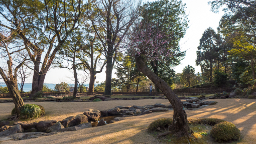
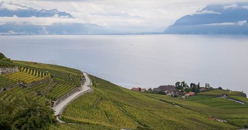
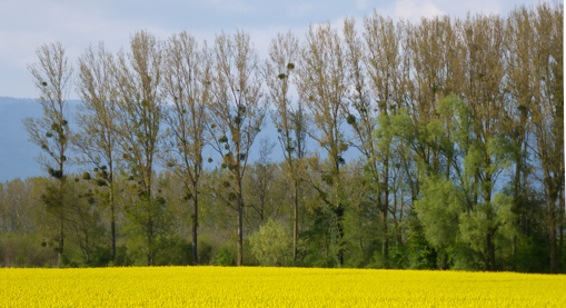
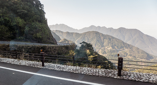
There is also a small airfield here. The fields of yellow flowers must be quite a sight from above. colza-30 .

The last stop on our Malaysian trip is Langkawi (浮羅交怡), an archipelago of 104 islands in the Anderman Sea. Situated in the North West corner of the Malay peninsula, it is very close to the Thai border. The Westin resort is located on the main island – Pulau Langkawi, and just about 10 minutes away from the main town named Kuah (瓜鎮), “melon” if literally translated.

westinresort-2

We got to the resort a few days later than the booked arrival date, after an unexpected detour to Hong Kong. We called ahead to make sure they did not resell our room.

westinresort-1

The resort is somewhat commercial as it has been here for a while. Apparently, it has recently been renovated and is in the process of expanding into a convention center which is under construction behind the resort.

westinresort-3

In addition to hotel rooms, they have free-standing villas along the beach front.

westinresort-10.

westinresort-8

The resort did a reasonably good job blending natural beauty with man-made amenities.

westinresort-9Predictable but not obtrusive.

westinresort-7

One major feature is the jetty. Hotel guests can reserve it for a romantic dinner or social function. A wedding ceremony was about to be held there on our last day.

westinresort-4Big change in water level due to tides.

westinresort-5.

westinresort-6

The lights were pretty at night.

westinresort-13

.

westinresort-21

But the jetty was a bit spooky.

westinresort-11

When we saw this notice on our balcony, there was not any sign of the animal.

westinresort-14

On our last day, when we opened the curtains, there was a troop of 10 or so monkeys just outside our window.

westinresort-15

We have no idea what kind of monkey it was. They are of a different species from the ones we saw in Kuala Lumpur, inside the Batu cave and temple.

westinresort-18

They hung around for about 10 minutes and one by one wandered off in different directions.

westinresort-16They were peaceful (unlike the ones in KL) and probably visit the resort regularly.

westinresort-19

A mother brought along a baby which was bright orange – there is no way one can miss that baby in a forest of dark green and brown.

westinresort-17

So how does the bright color confer a survival advantage to the baby ?

westinresort-20

The resort has a spa which is about 10-15 minutes walk away – the subject of our next post.

Continuing with our visit to Northern Italy – Barolo – one of the best-known Italian wines – are made in the village of Barolo in Piedmont.  Partly because of time-constraint, we did not visit any of the famous winery, like Conterno, … and not even Renato Ratti, owner of the villa where we were staying (see earlier post here).

terredavino-10

Instead, we visited Terredavino, at the suggestion of one of my Italian colleague. It is a super-modern top winery that services over 5,000 hectares of local vineyards cultivated by over 2,500 growers.

terredavino-9

If we understood our winery guide correctly, Terredavino acts as a collective facility to serve local growers who may not be able to afford all the equipment to make and bottle their wines.

terredavino-11

The growers join as members and the facility only makes DOC and DOCG regulated wines from grapes grown in Piedmont.

terredavino-12

The winery has a shop and enoteca for tasting.  I (Chris) did a quick flight of four reds and Sue just tried the Moscato d’Asti. We ended up buying several different Barolo, Barbera and Moscato D’Asti wines.

terredavino-16

It also has a library/bookstore for literature and maps about wine-making and cuisine.

terredavino-15

The architecture of the winery is so different from what one might expect from this very historic agricultural area. It was definitely designed to showcase itself to not just passing tourists like us, but also as we suspect, to grape growers and producers who pay to use the facility.

terredavino-4

According to its web site:

Grapes from the largest producer members are vinified separately and the name of the original producer appears on the label. The grapes from the small producers and particular lots are blended. In this case the labels contain the titles of books by famous local authors whose works speak about the lands which produce our wines.

terredavino-13

We were given a quick tour of the facility. This is the barrel room where the wines mature. This space is capable of containing up to 2,000 oak barriques in an area that is entirely temperature and humidity controlled.

terredavino-1

Oak barrique-matured wines are labeled “Superiore” if I remember correctly.

terredavino-7
This area is the bottling and automatic packaging lines with all functions carried out in a clean environment.

terredavino-2

The winery.terredavino-3

.terredavino-5

We encountered a group of Ferrari owners who had just gathered at the winery for drinks and snacks. Never seen so many in one place (all different model, even some vintage).

terredavino-14

Were they not all drinking and driving ?

terredavino-6

Off they go, a touring caravan of Ferraris.

terredavino-8Ciao.

Back to posting on the stuff we did in June in the Val de Loire …

The French National Riding School (Ecole nationale d’Equitation) founded in 1972 is located in Saumur. Take a look at their very helpful official website here. Much of the information here came from this site.

horses-1

We had a 2+ hour-guided tour (the only way visitors are allowed to see the place) led by a very knowledgeable English speaking guide. She is an university student majoring in tourism and working during her holidays.

cadrenoir-20

The National Riding School is founded on the knowledge and experience of the ecuyers (Riding Masters) of the Cadre Noir with a mission to develop horse training, to teach riding for sport, and to teach the equestrian professions.

horses-15

All the teachers of the National Riding School are members of the Cadre Noir. The principal purpose of the ecuyers, many of them military officers, each one a real expert in their own discipline, is to pass on their technical and theoretical knowledge.

horses-4

They also have to train and keep in condition the horses presented in the Reprise de Manège (Musical Ride), and those who perform the airs above the ground, as well as representing the school in national and international competitions.

horses-3

They are also entrusted with the preparation of the horses used in the training of their pupils. The school receives the French teams in the four Olympic disciplines: Dressage, Eventing, Jumping, and Paralympic. The school has many close ties with the École de cavalerie (Armoured Cavalry Branch Training School).

cadrenoir-21

The Grand Manège is used for lessons, international competitions, training, and Cadre Noir rehearsals and galas. With 1500 seats, it is one of the largest indoor arenas in Europe.  The mirrors positioned across the total width allow the ecuyers to observe the way of going and movements of their horses and to correct aids and posture.

horses-5

The National Riding School can accommodate around 500 horses in 4 perfectly equipped stables.

horses-16

Half way through the tour of the stables, Sue was allergic to something in the air and had to go back to the car.

horses-6

About 60 grooms look after the 330 horses belonging to the school on a daily basis.

horses-9

Heat lamps after shower.

horses-11

They are aided by a number of automated systems: distribution of water and feed, and getting rid of the poop. The flaked and cubed feeds drop into the mangers 3 to 4 times a day at set times.

horses-7
The feed requirements of each horse depend on his weight, his age, the breed, the outside temperature, but above all his level of work.

horses-8
The bedding produces up to 600 tonnes of manure each year, some of which goes to local mushroom growers.  This piece of information is alarming since we just went to a local mushroom grower and museum (see our posts here and here). Now we know where some of the black bits on white button mushrooms come from !

horses-13

The tour was fun because it allowed us some close-up moments with the horses. We had ample time to explore the stables and touch the horses.

horses-17.

cadrenoir-22

Our next post continues with the theme of “horses” and their role in war …

This is one of the three chateaux we visited in the Loire Valley. We chose Villandry because of its famous beautiful gardens.

villandry-1

Villandry is unusual in that it is a Renaissance castle that was the residence of neither a king nor a courtesan, but of Jean Le Breton, Minister of Finance for François I.

villandry-14

He drew on his experience supervising and directing the construction at many sites, including Chateau de Chambord (one of the trio, click here to see our post).

villandry-2

Its construction started in 1532 around a Medieval feudal fortress. In 1754, the interior was significantly upgraded in the neoclassical style by the then-new owner – Marquis de Castellane.

villandry-4

The interior of Villandry is much more habitable than Chambord and Chenonceau (the other famous chateau we saw, click here to see the post).

villandry-3

In 1906, it was purchased by Joachim Carvallo who began restoring the castle. The Carvallo family is the current owner of the estate.

villandry-5

Not only the castle was restored, the gardens which had been outstanding since the beginning was also recreated and reinvented according to the Renaissance style, based on old plans, archaeological and literary clues.

villandry-18

As you can see, there are many gardens: a water garden, ornamental flower gardens, and vegetable gardens.

villandry-7

.

villandry-9

.

villandry-8

Some of the photos looked like SimCity screenshots ?!

villandry-10

From the top of the turret, one can see all the formal gardens in their complex geometric shapes.

villandry-11

The gardens are laid out in formal patterns created with low box hedges.

villandry-12

At the ground level, the shapes are actually much bigger than we thought.

villandry-13

.

villandry-17


In 1934, Château de Villandry was designated a Monument historique. Like all the other châteaux of the Loire Valley, it is a World Heritage Site.

villandry-15.

villandry-16

It is worthwhile visiting their web site here for their collection of photos of the seasonally-changing gardens over the past years.

villandry-6


With Villandry, we concluded our visits of the chateaux of the Loire Valley.

Continuing with our journey into the caves of Saumur … People in the area did not just live in caves, they use it to store wine and to grow mushroom. See earlier post here about the museum.

mushrooms-14

The caves provide an environment of high humidity and constant temperature that is perfect for growing mushroom. Many of the caves were once part of a quarry. This facility at the museum produces four types of mushrooms commercially: white or brown button mushrooms, shiitakes, oyster mushrooms including the yellow pleurotes and blue foot mushrooms aka blewits (something new for us).

mushrooms-16

Using a plastic culture bag is the preferred way, as it is more flexible and prevents the spread of pests.

mushrooms-19

The white button mushroom or champignon de Paris (Agaricus bisporous) were first cultivated in the disused quarries in the Paris region, and then in the late 19th century, they moved to the Loire Valley.

mushrooms-18

Apparently, more than half of the mushrooms cultivated in France come from this area and Anjou (just a bit downstream of the Loire river).

mushrooms-20

The facility aims to provide ample ventilation (otherwise the mushroom will become deformed !), temperature at 10 to 18 degrees celsius, 14 degree being the optimal, and 85 to 90% humidity.

mushrooms-17

Shiitake or 冬菇 (Lentinus edodes), also known as black mushroom or oak mushroomare grown in the caves on substrates that were hung and resembled tree trunks.

mushrooms-22

Apparently, they are slow growing and do not appear until 2 to 5 years after inoculation. The growers stimulate growth by exposing the culture to shock, such as sharp change in temperature, mechanical vibration (including artificial thunder ? That’s what it said on the explanatory notes on the wall) or soaking in water.

mushrooms-23

Pleurotus ostreatus or 蠔菇, the oyster mushroom, are mainly cultivated in large polyethylene bags stuffed with hay, sawdust, wood chips, etc in layers, and spawn sown between these layers.

mushrooms-24.

mushrooms-25

Pleurotus citrinopileatus, the golden oyster mushroom (tamogitake in Japanese) is the other type of pleurotes that are grown in this facility.

mushrooms-26


.

mushrooms-27.

mushrooms-28

The last type of mushroom cultivated here is Clitocybe nuda (also recognized as Lepista nuda and Tricholoma nudum, commonly known as the wood blewit or blue stalk mushroom). We know nothing about it. According to Wikipedia, it is an edible mushroom, found in both coniferous and deciduous woodlands. It is a fairly distinctive mushroom that is widely eaten, though there is some caution about edibility. Nevertheless it has been cultivated in Britain, the Netherlands and France. … Blewits can be eaten as a cream sauce or sautéed in butter, but it is important not to eat them raw, which could lead to indigestion. They can also be cooked like tripe or as omelette filling, and wood blewits also make good stewing mushrooms. They have a strong flavour, so they combine well with leeks or onions. They were not in season or something … as this is all I could find in the tunnels.

mushrooms-21

Back to sunshine, the museum shop offers freshly picked mushroom for sale or as a snack. If it was our last day before heading home, we would have bought some.

mushrooms-29

It was an interesting and unique visit.